
Archive for the ‘Travel’ Category

Gordie Howe Bridge Walk

We took advantage of the newly-opened Gordie Howe Bridge’s free multi-use pathway. All the other methods of entering Canada from Detroit cost money. But thanks to our friends to the south, bicyclists and pedestrians are not charged any tolls on the GHB.

So on a sunny Sunday afternoon, we tried it out. Here are some things that we noticed, and some might be helpful for you to know before you go.

The signage is lacking
You enter through a nondescript building. Here is the building, as seen from the bike path that connects to it and takes you to downtown Detroit if you want.
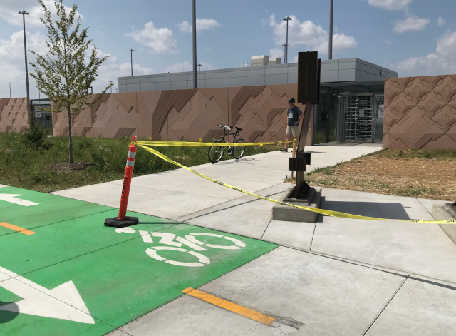
image of the border patrol entrance and exit to the Gordie Howe Bridge pathway

Can you tell if that closest doorway is the entrance or exit? No? Neither could we. It turns out that’s the exit, and the entrance is the farther door (left side of the photo, and the left of the two doors if you’re looking at the building from W. Jefferson).

The only way we could tell is by the sign off to the other side of the pathway.
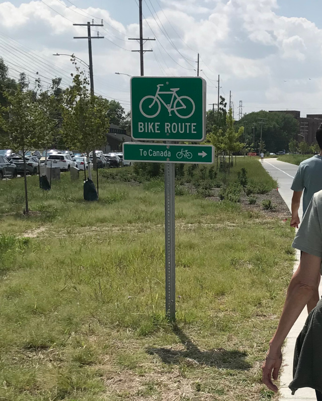
image of a sign for the border patrol entrance and exit to the Gordie Howe Bridge pathway

You could also try the doors, as the exit doors won’t let you in. We did not do that, as we didn’t want to attract the wrong kind of attention from the border patrol people.

There are 3 ways to get cross the border at Detroit/Windsor: 2 bridges and one tunnel. Approaching all of those by car, there are plenty of signs to direct you where to go, and you know where to go and what to do and what is expected of you.

With the bike path, there is none of that. No sign on or near the doors that says it is a point-of-no-return. Nothing that warns people they will need proper documents past this point. We generally knew what we wanted to do, but it was still a guessing game.

When we through the entrance, there was a line of people.
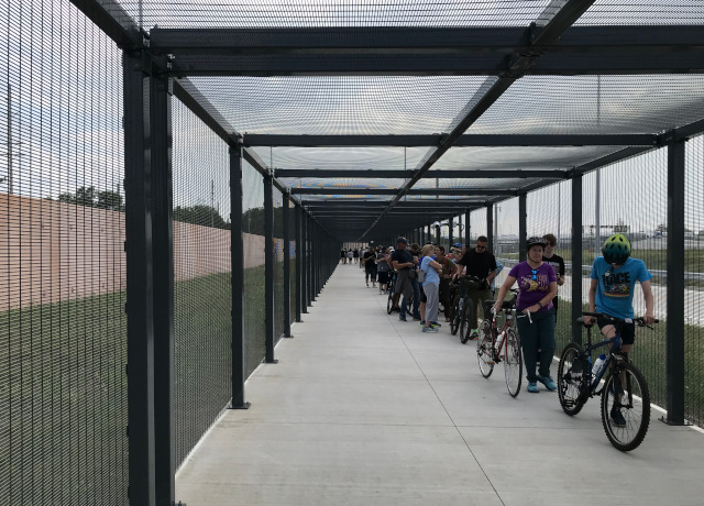
image of the line for the border patrol exit to the Gordie Howe Bridge pathway

We weren’t sure if that was the line to enter the official bridge pathway or what. We didn’t want to be rude, so we went the end of the line and started waiting. But it didn’t seem right because the line was facing the wrong way, so we asked people in line what the line was for and they said it was to get back into the US. If you want to go across the bridge, just go that way.

So we walked down the fully-fenced-in path (AKA the cage) and ended up on the start of the bridge. I turned around and took this picture, you can see the end of the cage on the right.
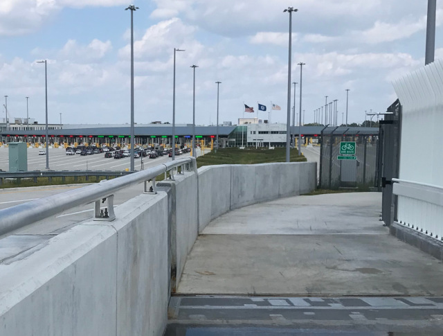
image of the border patrol transition to the Gordie Howe Bridge pathway

Once we were out in the open, it was a nice day – sunshine and a good breeze. The bridge was popular, but not too crowded. I expect once the novelty wears off it won’t be as popular.
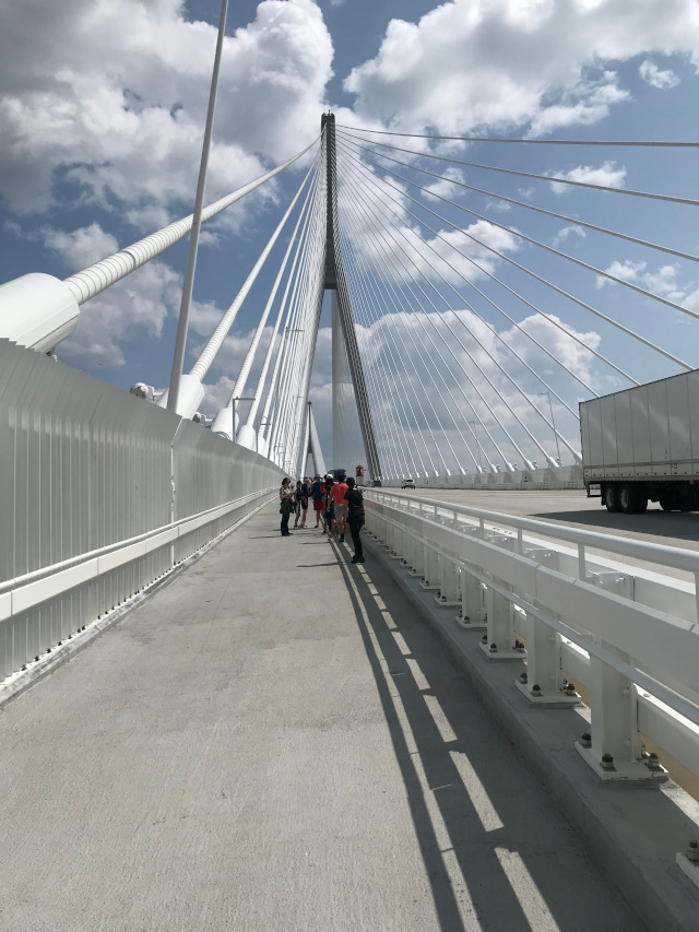
image of the Gordie Howe Bridge pathway

They have a fence along the whole way that is meant to discourage people from jumping off the bridge, so the view looks like this:
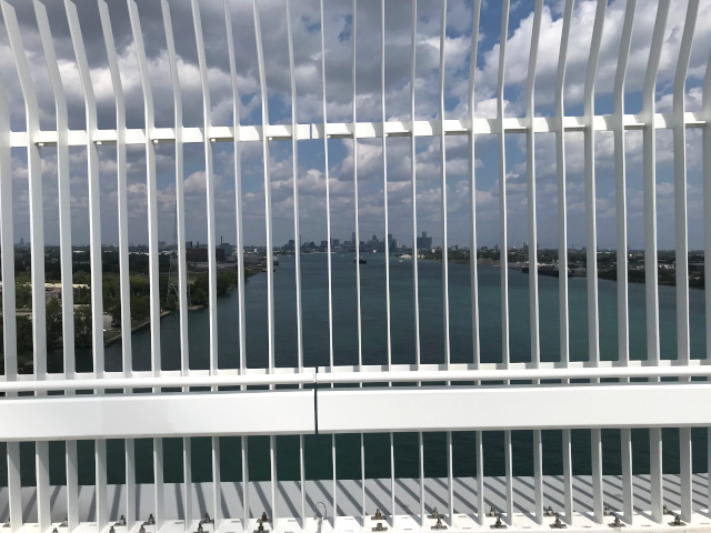
image of the fence along the Gordie Howe Bridge pathway

But if you stick you phone between those slats it looks like this:
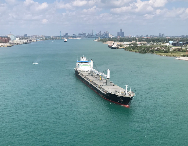
image of the Detroit River from the Gordie Howe Bridge pathway

It is required of all bridge walkers to get a picture from straight underneath one of the two main towers. Here is my participation in that.
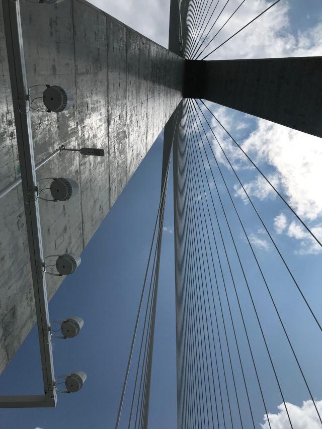
image of the underside of a tower of the Gordie Howe Bridge pathway

And at the halfway point on the bridge, there is a sign noting the actual border and some flags to help you remember which side is which.
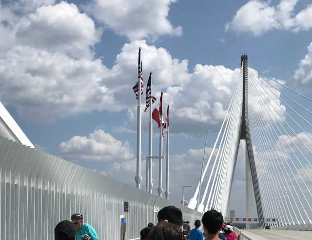
image of the border at the Gordie Howe Bridge pathway

We walked over the bridge, then when we got to Canadian soil, we turned around before having to go through Canadian border patrol.

There is not a good destination for walking.
After you get through the Canadian border patrol, you’re in an industrial area. It’s maybe half a mile to the nearest thing you could go to, which happens to be a Tim Horton’s because this is Canada.

I understand the industrial things there aren’t going to go away, because they are along the river for a reason and it’s not worth it to move things like electrical substations. But I would have liked a reason to continue my walk past the border patrol – give me a destination of some sort. Maybe someone is waiting for the initial flurry of activity to die down and see just how many bikers keep using the bridge, to justify setting up a cafe or bike shop or both near the bridge.

And it’s not just Windsor’s problem, the Detroit side isn’t much better. If you want a tour of bleak industrial settings, both sides of the bridge are fine.

The other two crossings (the tunnel and the Ambassador Bridge) take you to actual neighborhoods with things to do right there, but they don’t allow pedestrians. The GHB is the only one that allows pedestrians, but it was placed for direct access to the 401 freeway so there is not a good destination for pedestrians.

The trailhead is in the wrong spot.
The bridge website lists the official trailhead for starting in Detroit as the Clark Park. And it looks like a nice park. But there is not much parking, and it is almost 2 miles from the GHB pathway entrance. Nobody uses Clark Park to start their walk on the GHB.

There is street parking on W. Jefferson, all along the area by the GHB pathway entrance. There is a parking lot at the historical fort across the street too. And there is Delray Park just a block over and a block down. The official trailhead with parking should be close to the trail, not farther away from the trail than the trail is long.


So after we crossed back over the bridge and got back to the USA border patrol station, we joined the line confidently, knowing what the line was for. It was a long line but kept moving. An once we made it past the border we got in our minivan and left, mission accomplished. The consensus in the group seemed to be that it was fun to do once but no reason to do it again.

Today you shall cross over Ar, the border of Moab.

Deuteronomy 2:18
Black Sand

On a recent trip to the UP here in Michigan, we stopped by Whitefish Point. Whitefish Point itself is rather secluded, but it has enough to see that it is a popular place. We toured the Great Lakes Shipwreck Museum (which includes the bell from the Edmund Fitzgerald) and an old lighthouse. And then we wandered to the beach, which is mostly sand but has a lot of small rocks too.

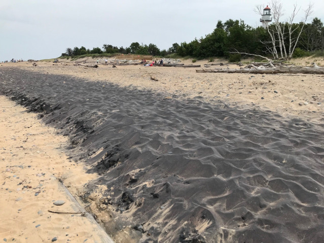
The most interesting part about this beach is the line of black sand near the shoreline.

picture of the black sand at the beach in Whitefish Point Michigan

The thing you need to know about Whitefish Point is that it is part of the “graveyard of the Great Lakes” in that it is one of the more treacherous areas and has a large number of shipwrecks. It also happens that many of the shipwrecks are freighters, carrying a variety of things but a common load was iron ore.

Knowing that sand in Michigan isn’t naturally black, and knowing that iron ore is, I told my son (because he was the only one with a magnet) to drag his magnet along the black sand and see what happens.

Sure enough, the black sand stuck to his magnet. Notably, the Edmund Fitzgerald was carrying iron ore on her last voyage, so some of what’s on that beach could be from that cargo.

a land where you will eat food without scarcity, in which you will not lack anything; a land whose stones are iron, and out of whose hills you can dig copper.

Deuteronomy 8:9

Spring Break 2026, Part 3

This is the third of a three-part series. You can also read about the first part of our trip to Florida here.

Day 7:
This day was Universal Studios Epic Universe (USEU) day. We had been seeing ads for it, and it looked fun. And we had some friends who went, and they liked it. And we don’t take our kids to theme parks (unless you count one trip to Cedar Point), so at least they can have had the experience.

We took the shuttle from the hotel to the park, and had no problems with that. The park was crowded, but the line to get in moved along well enough.

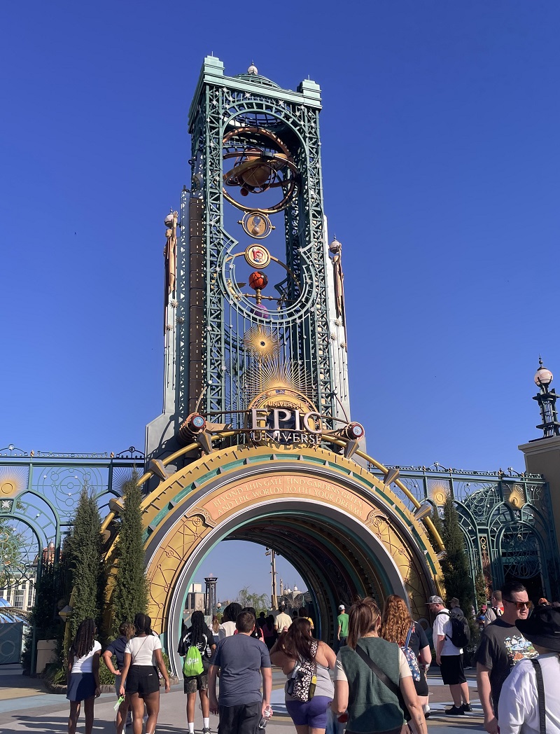
image of the entrance to Universal Studios Epic Universe

Thanks to the Universal Studios app, we could see the wait times for all the rides on our phone, so we headed first to the one that looked decent enough to ride and had a short-ish wait time. It was in the Isle of Berk.

Most of my experience with amusement parks has been Cedar Point. I like Cedar Point, but one thing that USEU did better than Cedar Point is that they have a lot of shade for people waiting in line and they also have drinking fountains along the way. Maybe in the Florida heat that’s more of a necessity than Ohio.

The different worlds were well done, with the right props and settings, people who stayed in character as they were walking off their post back to the break room, and different music in each area that set the mood. The music really was a nice touch, it was always there, not blaring, and even if you weren’t paying attention to it, it sub-consciously had an effect.

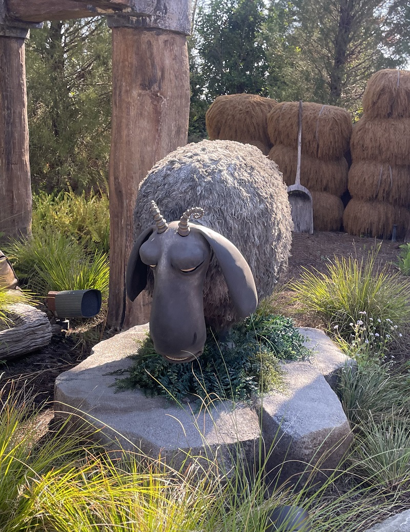
And there were plenty of props – some animate, some inanimate – to keep your attention, like this sheep in the Isle of Berk.

image of a sheep at the Isle of Berk at Universal Studios Epic Universe

(more…)

Spring Break 2026, Part 1

Like many Michiganders, we headed south for our spring break. Our destination was Florida. Normally you don’t want to go to Florida during spring break, as it is overrun with crazy college kids, but this was our high school’s spring break which was a couple weeks after most college’s spring break weeks.

It takes long enough to drive there that we decided to take two days to drive it.

Day 1:
Not a lot to report here. We took the boys to a Waffle House for the first time. It was fine, and now they can say they’ve been.

image of a Waffle House in Ohio

Our destination this day was just outside Atlanta. We got there with some daylight left, and we had been sitting in the car for several hours, so we took a short hike after dinner.

There was a small parking lot and trailhead by the Chattahoochee River. We picked it because it had the remains of an old mill on site, which the boys liked scrambling around.

image of a map of the Chattahoochee River trail near Marietta GA

image of an old mill at the Chattahoochee River trail near Marietta GA

Then it was evening, then morning the next day.

Day 2:
Our second day was a little more exciting than the first day. Still a lot of driving, from Atlanta to Tampa Bay. Tampa Bay was not our actual destination, but it was on the way and I wanted to see manatees and TECO has one of the better manatee viewing areas.

TECO is an electric power plant that uses the water from the bay/channel for cooling. The result of cooling the power plant is that the water in the channel gets the extra heat and makes it cozy for certain wildlife.

We walked down the boardwalk to the end and saw that the channel is separated from the rest of the bay, all the way out. I think so that manatees that come for the warm water don’t end up in a boating area.

image of the channel at TECO manatee viewing area

But despite all the great reviews and the whole setup, we did not see any manatees. All we saw were some fish, like this:

image of the fish under the boardwalk at TECO manatee viewing area

Someone at the viewing area told us “Due to the recent hot spell of weather, the channel got too warm for the manatees, so they moved out into deeper water. If you had been here a week ago, you would have seen a lot of them.”

So no manatees for us. We bought a manatee trinket at the souvenir shop as a reminder of this occasion.

On the plus side, the manatee viewing station also had a stingray tank, where you could try to pet a stingray as it swam past you. Maybe they called them just rays, because they’re not the stinging type. At least we got to do that.

image of the sting rays at TECO manatee viewing area

Then we continued on our way to the house, had dinner, confirmed timing for the next day’s plans, and went to bed.

Then it was evening, then morning, the next day.

Day 3:
This was our first full day in Florida. Our plan was to go to Sanibel Island and enjoy the beach. And maybe find some interesting shells.

For those of you not familiar with that area of Florida, there are lots of beaches, and almost enough parking. And the parking is not free. It was only about $5 per hour, cheaper than most cities, but you do have to have your phone to pay online.

The groups of islands in that area are connected via bridges for the most part. Here is the view getting onto Sanibel.

image of the bridge going onto Sanibel Island

We chose Sanibel because we heard it had a lot of shells. What was interesting was there wasn’t much sand – the beach was all tiny bits of broken shells. But the boys did find some shells, including a couple that were alive. Most of the good shells had been taken, the beach was full of other people also looking for shells.

Our first stop was right after the bridge, at the lighthouse.

image of the lighthouse at Sanibel Island

I thought the lighthouse was rather bleak. I later saw pictures of what it looked like before the last hurricane and it was not so bleak back then.

And here’s what the beach looked like

image of the beach at Sanibel Island

For lunch that day, we had packed a lunch. We found another beach, this one with some shade, and sat in our beach chairs and watched the ocean. Here’s the view from our picnic spot.

image of a beach with driftwood at Sanibel Island

We ended up driving to about 3 different beaches, trying them out and seeing if the shells were better anywhere.

Then we drove back to the house for dinner, confirmed timing for the next day’s plans, played Phase 10, and went to bed.

Then it was evening, then morning, the next day.

To Be Continued…

For You said, “I will assuredly make you prosper and make your descendants as the sand of the sea, which is too great to be counted.”

Genesis 32:12

Summer Break 2025, Part 3

This is the third of a three-part series. You can also read about the first part of our trip to OBX here.

Day 6:
Mostly driving. Made it from OBX to Pittsburgh.

Then it was evening, then morning, the next day.

Day 7:
We spent the day touring Pittsburgh. I heard that Pittsburgh is very pedestrian friendly and one does not need a car to get around, so I picked a hotel downtown and left the car in the parking lot during our stay.

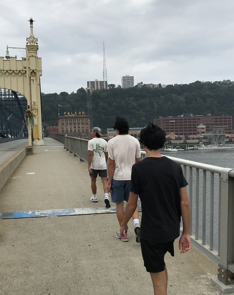
After a nice breakfast at the hotel, we walked out the front door and headed toward the river, and then walked over the bridge to get to Station Square. It was a few blocks of walking, it felt to me like a good way to start the day and get a feel for Pittsburgh.

image of walking over the Smithfield Street Bridge in Pittsburgh Pennsylvania

(more…)

Summer Break 2025, Part 2

This is the second of a three-part series. You can also read about the first part of our trip to OBX here.

Day 3 Continued:
It wasn’t that long of a drive from the Great Dismal Swamp to Kitty Hawk, so we drive straight to the first tourist attraction on our list rather than going to the hotel. Plus it was mid afternoon and the Wright Brothers Memorial closed at 5pm so the best plan seemed to be to see the WBM first and then just relax for the evening at the hotel.

One thing I learned at the memorial is that Wilbur Wright died as a result of eating bad oysters, which helped further my resolve to not eat non-fish seafood. The memorial thingy is on top of a hill. But the official flight stuff is in the meadow next to the hill so the hill is some sort of misdirection.

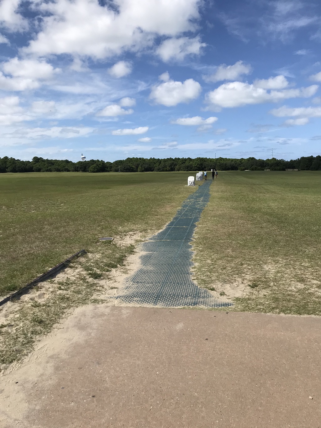
Here’s the view from the airplane launch point toward the landing markers.

image of the Wright brothers memorial at Kitty Hawk North Carolina

(more…)

Summer Break 2025, Part 1

I had heard good things about the Outer Banks of North Carolina, so that area was on my list of places to visit eventually. No one came up with other ideas, so we went to the Outer Banks (AKA OBX).

Plus I wanted to get there before the ocean levels rise and wipe out coastal touristy areas.

Day 1:
We drove. All day. Made it to Virginia.

Then it was evening, then morning, the next day.

Day 2:
We took a break from a lot of driving and did some hiking.

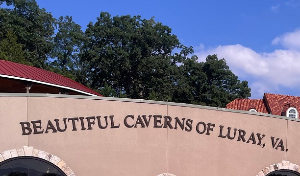
Our first activity was a cave tour. We have toured a number of caves and I don’t know that I would have been that excited about this one, but they do have the world’s largest musical instrument – the Stalacpipe Organ.

image of the caverns at Luray Virginia

Much of the cave was the typical cave stuff, but it was a self-guided tour so we didn’t get the turn-off-all-the-lights bit.

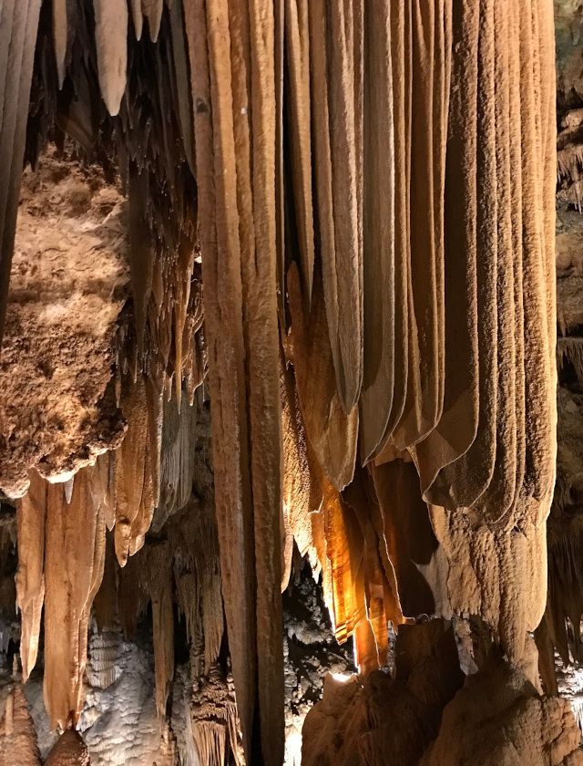
This formation was called Curtains:

image of the curtains formation at Luray Caverns

(more…)