
 This is Alpha, the first-born, when he was 2YO.
 This is Beta, the second-born, when he was about 2YO.
 This is Gamma, the third-born, when he was about 18MO.
Vacation Recap 2019, Part 3
Oct
2
2019
Continued from last week
Day 6
We had a typical breakfast that we would have at home – cereal and bagels and stuff like that. And then we were off on our day of adventure in the greater Marquette area. First up: Presque Isle.
Fun fact: Presque Isle was designed by the same guy who designed New York City’s Central Park. Maybe “designed” is the wrong word for it – more like “conserved”.
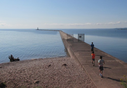
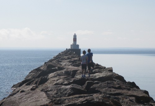
Our first stop was to the mini lighthouse. I think officially it is a beacon, not a lighthouse. But either way, the walk out there was something that the boys liked. It was somewhat harrowing, but the lake was rather calm so it could have been worse.
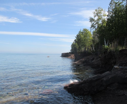
Then it was on to Black Rock. This is a formation on the north end of the isle. The boys mostly liked the Great Lakes version of tide pools that were there, but we also got to see some locals going cliff diving.
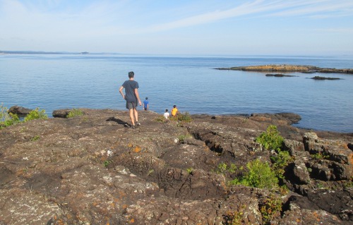
Then we did a short hike along a path and ended up on a small outcropping on the shoreline.
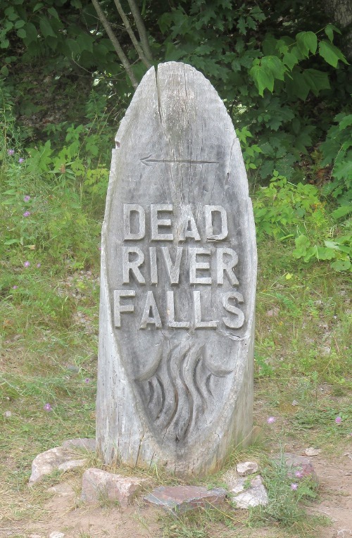
Then I think we went back to the house for lunch (leftover Chinese food, I think), and after time for lunch to digest we headed out to Dead River Falls. It’s rather well marked, for an unofficial thing.
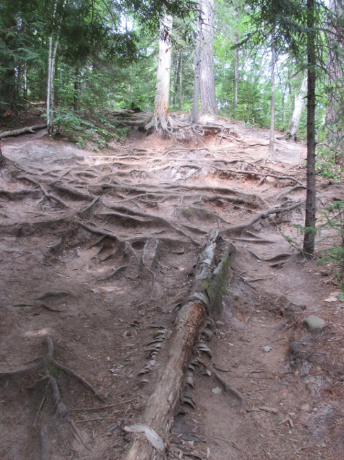
The trail along it was rather, umm, natural – using tree roots for steps.
But only I and Alpha used the path – the other boys walked upstream in the river, climbing the rocks to get up the waterfalls.
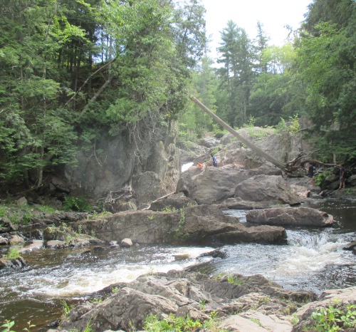
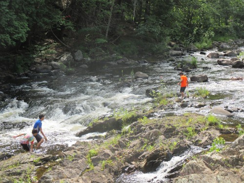
We spent a couple hours there, and I think the younger boys could have spent even more time if we had let them.
Then it was back to the house for dinner, and then we walked to downtown Marquette. There was not a lot going on there, but we did stop at Donckers for some ice cream. Friendly people there – be prepared to discuss your activities of the day.
Then a walk back to the house – we split up so some used the sidewalks and some used the bike path. Then it was evening, then morning the next day.
Day 7
More Marquette things. First off, a drive through NMU. Here’s a shot I took of the Superior Dome (taken actually from day 6 on Presque Isle, but it’s the only shot of something from NMU so I’m putting it here).
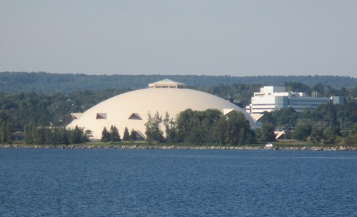
It is one of the claims to fame of the state of Michigan, being the world’s largest wooden dome. Sure, other schools have football teams that play in domes, but none of them are rigid structures made of wood.
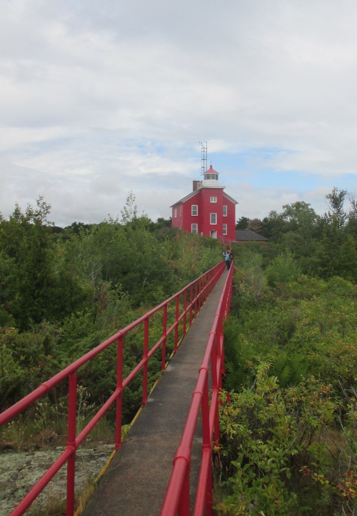
It was lightly raining, so we didn’t want to get out and walk the campus, so we drove through it and ended up at our next destination: the lighthouse. Unlike the beacon from day 6, this was an actual lighthouse and it was open for tours (for a fee, of course).
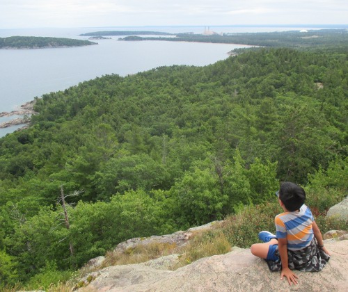
Then we ate our packed lunches in the van, and we headed out to Sugarloaf mountain. It is called “mountain” but I don’t expect it meets the definition of a mountain. Large hill, sure, which is good enough for us Michiganders to call it a mountain.
Then we changed our plans a bit. We were going to tour the Pictured Rocks on our way out of town the next day, but this day’s activities ended up being shorter than expected so we decided to see Pictured Rocks this day. We drove back to the house so I could get on the wifi and buy tickets online. No sense driving an hour only to find out the boat was full. With the tickets purchased, we headed out.
We got there a bit early so we could grab dinner (went to Eh Burger. If you have to ask, you have never been to the UP) before the tour. Evening tours are supposed to have the best light, so that was another plus for doing the tour tonight instead of tomorrow.
Here are some photos of the evening:
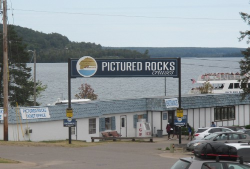
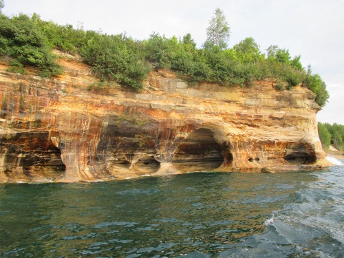
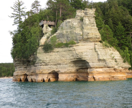
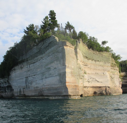
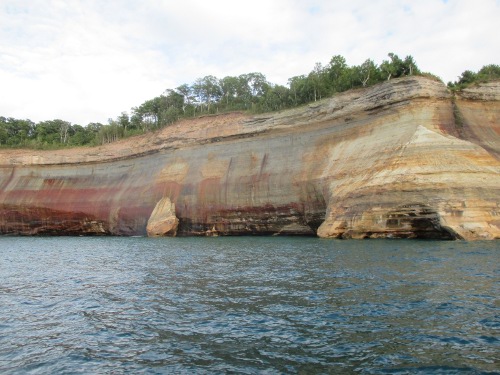
Also of note: Pictured Rocks are another claim to fame of Michigan’s – America’s first National Lakeshore.
Also also note: on our boat’s drive out (the tour is a boat ride out to a point, then turn around and go back. Same views, just faster and without commentary) we passed a group of kayakers and a pontoon boat. We found out later that the pontoon boat was for a drone photographer, who happened to film the Pictured Rocks almost hitting the kayakers.
Then we went back to the house and packed some things up in preparation for tomorrow.
Then it was evening, then morning the next day.
To Be Continued…
For the Lord your God is bringing you into a good land, a land of brooks of water, of fountains and springs, flowing forth in valleys and hills;
Deuteronomy 8:7


This little article thingy was written by Some Guy sometime around 6:42 am and has been carefully placed in the Travel category.